

TRAVEL-GUIDE.APP
Expert reviews on the best travel apps
Indianapolis

Top 10 Essential Travel Apps for Exploring Indianapolis

Indianapolis is a vibrant city that blends rich motor sports history with a thriving downtown culinary scene. Whether you are in town for the Indy 500 or exploring the cultural trail, visiting such a dynamic destination requires strategic planning. Fortunately, your smartphone is the ultimate travel companion, and having the right tools installed can transform a good trip into an unforgettable one. From navigating the transit systems to finding the best local restaurants, these travel apps are designed to help you make the most of your time in Indianapolis.

The verdict: the most useful app for Indianapolis according to our editors is

Transit - Subway & Bus Times Icon

Transit - Subway & Bus Times

Comprehensive real-time public transit tracking • Multi-modal trip planning • Digital ticket management • Offline schedule access

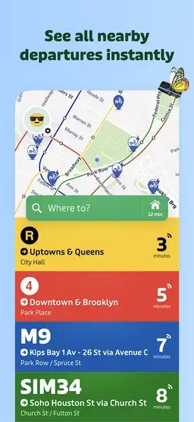
For any traveler relying on public transportation, Transit - Subway & Bus Times is arguably the most useful app for navigating Indianapolis. Whether you are catching the Red Line or hopping on a local bus route, this app eliminates the guesswork. It provides accurate, real-time arrival data by pulling information directly from transit agencies, ensuring you aren't left waiting at a stop longer than necessary. One of the app's standout features is its multimodal trip planning; it calculates the fastest route from point A to point B, even combining buses with bikeshare options. During a busy weekend in Indianapolis, this capability is invaluable. While you are exploring, you can also access offline schedules, which is a life-saver if you find yourself in an area with spotty data. The GO navigation feature is particularly helpful for visitors, as it provides departure alarms and alerts you exactly when to get off the bus, essentially acting as a digital tour guide for the city's transit network. Beyond basic movement, the app excels at offering crowdsourced data, giving you a real-time sense of crowding levels on specific lines. It also facilitates in-app fare payments for various services, streamlining your journey. By consolidating fragmented data into one easy-to-use interface, Transit beats out competitors like standard mapping software, which often struggles with local transit nuances. It is a comprehensive, one-stop shop that helps you get anywhere in the city without needing a car. Whether you are heading toward a major event or just commuting from your hotel to a local cafe, this app ensures you travel with the confidence of a local, maximizing your time and minimizing unnecessary travel stress.
Screenshot
Pros
  • Precise real-time transit data
  • Comprehensive multi-modal trip planning
  • Offline access to schedules and maps
Cons
  • Battery drainage due to GPS usage
  • Occasional inaccuracies in vehicle tracking

Other useful apps for visiting Indianapolis

Once you have your transit plans sorted, you will need to round out your travel toolkit with apps for payments, local discovery, and navigation. The following selections cover everything from stadium logistics to finding the best locally owned dining spots in the city.
MyKey Icon

MyKey

Mobile fare system for IndyGo bus services featuring digital ticketing, account balance management, and automatic daily and weekly fare capping.

Navigating IndyGo is made significantly simpler with MyKey, the official fare system application. If you plan on utilizing Indianapolis's public transit frequently, this app is indispensable. It solves the common tourist headache of needing exact change or physical tickets by allowing you to pay fares digitally. You simply scan a QR code on a mobile fare validator on any local bus or at a Red Line station. Perhaps the best feature for visitors is the automatic daily and weekly fare capping. This ensures you never overpay; once you hit a certain spending threshold, your rides for that period are effectively free. It provides a seamless experience, allowing you to add funds to your account via credit or debit card and monitor your balance in real-time. If you are traveling as a group or family, you can link your accounts to share resources. While standard mapping apps show you where to go, MyKey ensures you have the financial access to actually get there without hassle. It is the definitive way to manage your transit budget while enjoying the convenience of a modern, contactless payment system in Indianapolis.
Key Features
  • Mobile QR code fare payment
  • In-app fare loading and balance checking
  • Automatic fare capping
  • Account and card management
  • Trip planning integration
Indianapolis Motor Speedway Icon

Indianapolis Motor Speedway

Enhance your at-track experience with digital ticketing, interactive venue maps, event schedules, and fan-exclusive interactive content.

If your visit to Indianapolis includes a trip to the legendary Indianapolis Motor Speedway, you need the official Indianapolis Motor Speedway app. This is the ultimate tool for at-track enthusiasts, streamlining the complex logistics of attending a major race. It serves as your primary hub for digital ticketing, ensuring that race-day entry is quick and secure. Beyond tickets, the app features an interactive track map, which is crucial for navigating the massive venue—helping you easily locate your seating area, nearby concessions, and merchandise stands. You can customize your schedule to ensure you don't miss qualifying rounds, concerts, or fan events. The app also adds a layer of fun with exclusive quizzes and a photo wall to capture your memories. By housing your tickets, event maps, and schedules in one interface, it removes the stress of carrying physical papers or navigating the stadium's layout blindly. For any racing fan visiting the 'Racing Capital of the World,' this app provides the necessary digital bridge between the fan experience and the track's high-octane environment.
Key Features
  • Digital ticket management
  • Interactive track mapping
  • Customizable event schedules
  • App-exclusive fan quizzes and photo sharing
Offline Restaurant Club Icon

Offline Restaurant Club

Curated restaurant discovery platform • Exclusive monthly dining credits • Local-first recommendations for top-tier dining spots

To truly eat like a local in Indianapolis, you should download the Offline Restaurant Club. Unlike generic review platforms that are filled with influencer noise and tourist traps, Offline focuses on curating the best locally owned dining spots. It solves the 'paralysis of choice' problem by providing a straight-up list of high-quality eateries. The app's greatest strength is its membership-based credit system, which offers you exclusive incentives to actually visit these restaurants. Each month, you receive credits that you can use to enjoy significant discounts at participating local gems. It encourages you to explore beyond the main tourist hubs, supporting the independent businesses that give Indianapolis its unique flavor. The interface is intuitive, allowing you to filter choices by vibe, cuisine, or location. By downloading this, you are not just getting a list of places to eat—you are getting a nudge to get off your phone and experience the city’s culinary heart. It is the perfect app for travelers who prioritize authentic, local experiences over chains.
Key Features
  • Curated restaurant discovery
  • Membership credit system
  • Personalized filters by cuisine and vibe
  • Bookmark favorites
Uber - Request a ride Icon

Uber - Request a ride

Comprehensive ride-hailing and delivery platform • Multiple vehicle types including eco-friendly options • Upfront pricing and integrated safety features

When public transit or walking isn't feasible, Uber remains the most reliable rideshare choice in Indianapolis. It is particularly useful for late-night transportation or trips where you need to move quickly between disparate parts of the city. The primary problem it solves is the uncertainty of finding a taxi; with Uber, you can request a vehicle to your exact location, track its progress, and see an estimated arrival time. The upfront pricing feature is essential for travelers, as it removes the worry of 'surprise' fare spikes that can happen with traditional transport. Uber offers a variety of service tiers, from standard UberX to higher-end options like Comfort and XL for larger groups. If you are arriving at the airport or need to reach a remote attraction, the app provides a stress-free solution. Its integration with food delivery via Uber Eats also adds value, allowing you to easily order local meals to your hotel room after a long day of sightseeing. Despite occasional surge pricing, its reliability and widespread availability make it a staple for any well-planned trip to Indy.
Key Features
  • Real-time ride tracking
  • Advance ride reservations
  • Split fare functionality
  • Integrated food and grocery delivery
  • Business travel management
Google Maps Icon

Google Maps

Comprehensive global mapping with live traffic, multi-modal navigation, and detailed local business insights.

While city-specific apps are great, Google Maps remains an absolute necessity for general exploration in Indianapolis. Its global reach makes it the most consistent navigation tool for driving, cycling, or walking across the city. It excels at local discovery; you can easily look up the top-rated museums, parks, or shops, complete with user photos and real-time business hours. One of the most useful features for a traveler is the ability to download offline maps, which saves your mobile data and provides peace of mind if you lose service. Google Maps also provides the most up-to-date information on traffic, helping you avoid major roadwork delays during your commute. Whether you are trying to find the nearest coffee shop or navigate the complex streets downtown, its turn-by-turn voice navigation is unparalleled. Its community-driven content, such as 'busy times' for popular locations, is incredibly helpful for planning your day to avoid crowds. For any traveler, this app is the baseline for exploration—it is the one app you will open dozens of times a day to ensure you are never truly lost.
Key Features
  • Turn-by-turn navigation
  • Live traffic and rerouting
  • Offline map support
  • Street View and Immersive View
  • Local business discovery and booking
WRTV Indianapolis Icon

WRTV Indianapolis

Comprehensive Indianapolis local news • 24/7 live video streaming • Real-time weather alerts and interactive radar

Staying informed during your stay is easy with WRTV Indianapolis. This app is particularly valuable for its focus on local news, breaking alerts, and, most importantly, weather. Indianapolis weather can change in an instant, and having access to a local weather team’s radar is essential if you are visiting for an outdoor festival or a race. The app provides 24/7 live streaming, which is great for keeping up with regional developments or traffic issues that might impact your travel plans. By providing context on local issues, it helps you feel more connected to the city rather than just seeing it from a tourist's perspective. The interface supports dark and light modes, making it easy to check headlines in bed or bright daylight. While it may not be a navigation app, it is a crucial resource for staying safe and informed, offering a level of local depth that national news apps simply cannot provide. If there is severe weather or a significant event happening in the city, this is the first place you should look for accurate information.
Key Features
  • Live news streaming
  • Interactive weather radar
  • On-demand video clips
  • Dark and light mode support
INDOT Trafficwise Icon

INDOT Trafficwise

Official Indiana traffic information with real-time road condition alerts, interactive maps, and statewide camera network access.

If you are driving in or around Indianapolis, INDOT Trafficwise is the official source for the most accurate road information. This app is essential for staying aware of highway closures, construction zones, and traffic incidents across Indiana. It offers hands-free audio notifications, allowing you to stay focused on the road while receiving updates on upcoming traffic events—a key safety feature for any driver. The app features a robust network of traffic cameras, letting you view live conditions before you even start your engine. You can also track the location of snow plows in real-time, which is incredibly useful if you happen to be visiting during the winter months. By allowing you to manage a personalized account for your saved routes, it gives you a tailored view of the roads you use most frequently. While mapping apps are great for navigation, INDOT Trafficwise provides the granular, official government-level data that can help you avoid massive traffic bottlenecks, making it a critical tool for any visitor who has rented a car.
Key Features
  • Hands-free audio traffic notifications
  • Zoom-enabled interactive map
  • Real-time traffic speeds and road closures
  • Personalized My INDOT accounts
  • Live traffic camera streams
  • Snow plow location tracking
Indianapolis Colts Mobile Icon

Indianapolis Colts Mobile

Official Indianapolis Colts hub • Integrated digital ticketing and rewards • Real-time stats and exclusive team content

The Indianapolis Colts Mobile app is a must-have if you want to immerse yourself in the city's sports culture. Beyond just being a news hub for the team, this app serves as your gateway to gameday experiences at Lucas Oil Stadium. It offers seamless integration for digital ticket management, which is essential for entering the stadium without hassle. You can sell, transfer, or access your tickets directly from the app interface. It is also packed with exclusive behind-the-scenes content, player stats, and roster information that you won't find on broader sports apps. For fans attending a game, the app keeps you updated on in-stadium promotions and Pro Shop deals. It is a one-stop-shop for everything Colts-related, ensuring you stay connected to the team’s narrative throughout your stay. Whether you are a die-hard football fan or just enjoying the local atmosphere, this app elevates the gameday experience and keeps the local excitement right at your fingertips.
Key Features
  • Digital ticket management
  • Real-time game statistics and scoring
  • Loyalty rewards and retail integration
  • Breaking news and push notifications
  • Team roster and depth chart information
Ride with GPS: Bike Navigation Icon

Ride with GPS: Bike Navigation

Advanced cycle navigation • Offline map support • Global route planner • Live tracking & performance analytics

Indianapolis has invested heavily in cycling infrastructure, such as the Indianapolis Cultural Trail, making Ride with GPS the perfect app for active travelers. It is arguably the best mobile route planner for cyclists, providing turn-by-turn voice navigation that works reliably on city trails. The app solves the problem of getting lost in a new city while trying to ride; you can discover local curated routes that lead you through the best parts of Indianapolis, from beautiful parks to historic neighborhoods. A standout feature is the Global Heatmap, which shows you exactly where the locals ride, helping you find paths you might otherwise miss. If you are looking to save battery or ride in areas with weak cellular coverage, you can download offline maps to use during your trek. It also integrates with various Bluetooth sensors if you are a serious athlete wanting to track your performance data. By combining local expertise with precise GPS tracking, this app is the gold standard for anyone wanting to see the city on two wheels.
Key Features
  • Turn-by-turn voice navigation
  • Mobile route planner with heatmap overlays
  • Shareable real-time location tracking
  • Bluetooth sensor compatibility
  • Offline map downloading
App Icon
Now viewing